The NCAR ensemble is a 10 member ensemble run at 3-km horizontal resolution initialized once a day at 0000 UTC and run for two days.
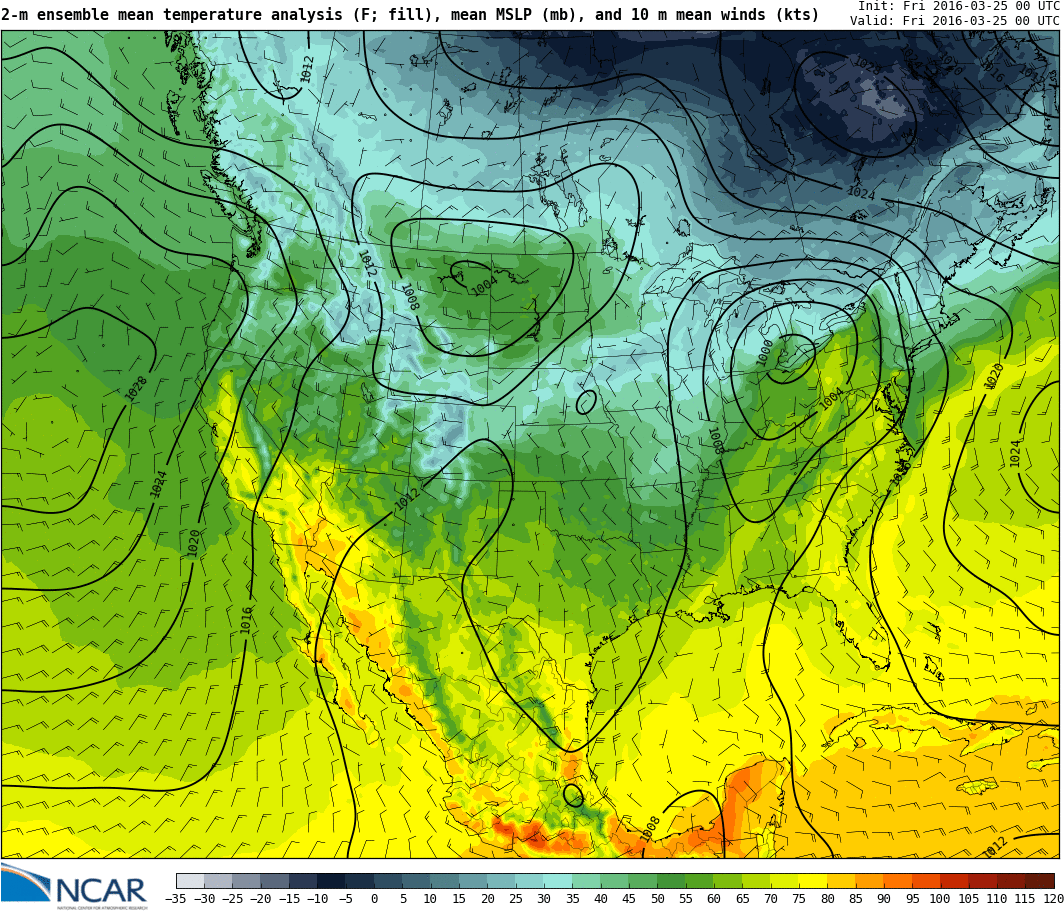
Here's the maps for the southwest 2-m mean temperatures, sea level pressure, and 10-m wind: http://ensemble.ucar.edu/images.php?d=2016032500&f=t2_mean&r=SW&i=1
(note: you can toggle on/off the county lines by pressing [o])

Also interesting is seeing the data assimilation for the model. Here's a map showing the locations of the data used in the model.

The data assimilation is feed into another model to create a 15-km analysis of atmosphere every 6 hours which is used in the forecast model. You can look at analyses here: http://www.image.ucar.edu/wrfdart/rta/images.php?d=2016032500&f=t2_mean_f000_ANLYS&r=CONUS
No comments:
Post a Comment
Note: Only a member of this blog may post a comment.