Showing posts with label Thunderstorm. Show all posts

Tuesday, July 17, 2018

Summer Thunder

I woke up last night at 11:40 to strobing lights. A long line of thunderstorms stretched from Richfield to the Utah-Idaho border. This morning I measured 0.26 inches of rain in south Provo.
Radar 11:50 PM, Local Time

It was a forecast miss for the HRRR model, which didn't simulate this particular line of thunderstorms until the analysis hour. This is an important lesson on not using weather models as deterministic forecasts for thunderstorm prediction. This loop of HRRR forecasts shows all 18 forecasts and the analysis valid at 0600 UTC (local midnight). Beyond the first two hours, there is no warning of this particular line of storms.

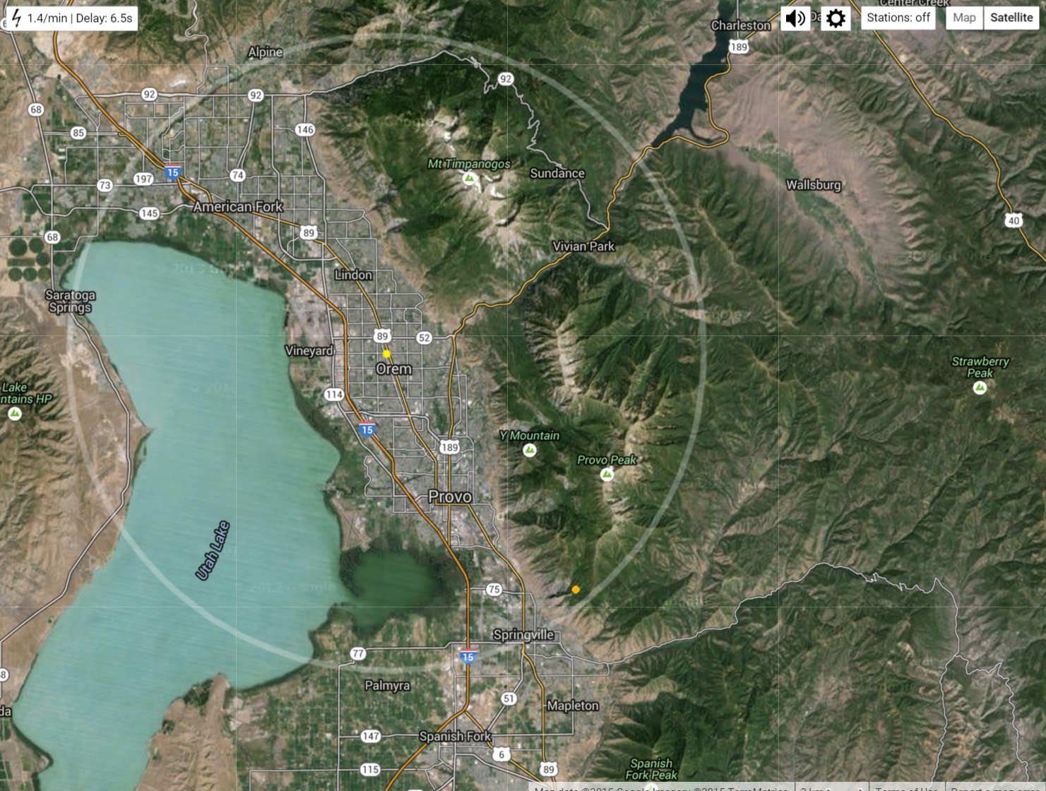
Started a small fire on Y-Mountain: https://www.heraldextra.com/news/local/central/provo/lightning-sparks-small-brush-fire-on-y-mountain/article_ad4d2531-58a6-5b62-800e-0e38e3be22ca.html

Gusty winds were observed across the state. The Salt Lake International Airport and many other locations along the Wasatch Front recorded winds exceeding 50 MPH between 11 and Midnight last night.

In Spanish Fork, recorded winds gusted ranged between 17 and 30 MPH.

UKBKB (bench): Max gust 17 MPH at 11:35 PM


C9348 (bench): Max gust 18 MPH at 11:33 PM


UCC13 (river bottoms): Max gust 30 MPH at 11:15 PM

KSLC (Salt Lake City International Airport): Max gust 50.6 MPH at 11:20 PM

Wednesday, September 14, 2016

First sighting of snow!

Last nights rain and thunderstorm was quite impressive in Utah county. The lightning lit up the sky with long and loud bolts of lightning. I got off the train at 7:30 and drove to my new apartment in Orem in this downpour...
The roads were splashed with so much water I couldn't see the lines painted on the road. Makes it hard to drive when you are staring at the sky watching the lightning!

My new roommate and I needed to pick up a few things at Walmart, so headed back out. After pulling out of the Taco Bell drive through it started raining again. By the time we got to Walmart it was another downpour.

Jake was nice enough to drop me off at the door. When he got inside the store he looked like he had just got out of the shower with water dripping off his head and covering his glasses, making them useless. Ironically, one of the things we needed was a shower curtain.


It rained again around mid-night. This was quite the storm, and much needed for our drought parched valley. CoCoRaHS shows Orem-Provo had 0.31 inches in at least one spot.


This morning, I looked out the window and what did I see? Snow on Mount Timpanogos above 10,000 feet!


Wednesday, June 29, 2016

Thunderstorm threat

At my teams softball game I was worried we might get rained on, but instead the sky showed off some really neat clouds. It looked like the thunderstorm was being sheered apart by strong winds aloft.

Some neat mammatus clouds


Thursday, July 9, 2015

Large Lightning Storm and Lots of Rain


Last night was the largest display of lightning I have ever seen! Frequent flashes of lightning illuminated the entire night sky.


A friend and I drove out to the get a better look. It was strange to see so much lightning right above out heads but not hear any thunder. The sound must have been drowned out by the heavy rain.


We were parked near Utah Lake State Park watching the storm. From the radar it looks like the storm intensified as it moved north into Salt Lake County. 
July 8, 2015 Radar 9:10 PM - 11:20 PM
It looks like the HRRR model got this storm right. The analysis soundings show much less CAPE at 6:00 PM than the amount of CAPE three hours later...

CoCoRaHS observations show nearly an inch of rain measured yesterday in parts of Salt Lake county, and farther north saw over an inch. The Salt Lake Airport reported 0.93 inches that fell in a two hour period. The NWS issued a flash flood watch. Even in Provo, there was a lot of rain running down the streets. 

The winds last night in Spanish Fork must have been strong because tree limbs about hit the truck out front...

Nothing in the wind observations sticks out to me, except for the 20 mph gusts after 20:00 (8:00 PM)


This event happened on the same day as the NWS reported that 14 people have died by lightning strikes this year, double the amount of last years (read here)
Read about lightning safety here.

Tuesday, July 7, 2015

Summer Thunderstorms

Yesterday's cooler temperatures were welcomed by many. Over the last five days in Spanish Fork we've been in the upper 90s but yesterday we cooled to the upper 80s as a daily high.

It was fun to see the some thunderstorms yesterday. I was outside watching the approaching lightning storm while waiting for the train. The rain drops were really large, and I got on the train just before it started to downpour!


CoCoRaHS show 082 inches of rain on the west side of the valley. I imagine this rain fell over a short period of time.


Last weekend I was up in the Sawtooth mountains and our first night we were treated with a good thunderstorm. Here's the video...


On the way home there was a lot of convection in central Idaho.


Tuesday, June 30, 2015

Hot Cool Down

It's been a hot week in the western states. Tonight we're getting some relief in some parts. I'm sitting just outside my front door feeling the cool breeze from the downdraft of a thunderstorm.

It looks like there is widespread rain in Utah county, but not many drops are actually.

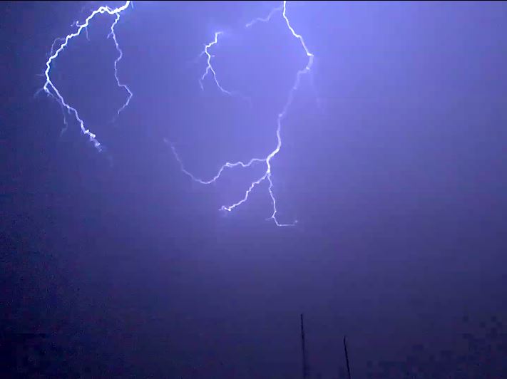
Wow! Just saw the flash of light from this strike, and heard the thunder...

As I was saying, not many rain drops are reaching the ground. The radar illusion is caused because the rain drops are evaporating before they hit the ground. When the temperature reaches the wetbulb temperature we can expect rain, but a low wet-bulb temperature means the air is dry enough for water to evaporate. Yep, still a large gap between the actual temperature and the wetbulb temperature...


 Evaporating water causes air to cool and sink rapidly. When the sinking air hits the ground it spreads laterally. That is why it has been fairly gusty here in Provo the last 15 minutes. See the recent spike to 15 mph winds...

Tomorrow I'll share and discuss some pictures of rain I experienced in Idaho's Sawtooth Mountain Range this weekend.

Tuesday, June 16, 2015

June 15 Evening Thunderstom

Last night's thunderstorm in Salt Lake City may have caused and increase in ozone at several air quality monitoring stations. Thunderstorms can cause increased ozone because lightning creates NOx, a compound that is a precurosr pollutant that can create ozone. Also strong downdrafts from thunderstorms can transport stratospheric ozone down to the surface.
Circled in Red is the ozone increase during the time of the thunderstorm.
lighting_ozone
Radar at 23:05 Local time
radar_SLC_20150615-23-05-local
Lots of CAPE that evening from the HRRR sounding (21:00 local time)
HRRRSKEWT_KSLC2015061602F000
Screen shots from a video of lighting captured by Ansley Long
lightning_ansley_longlightning_ansley_long2


And more from Twitter
lightning_twitter

Sunday, June 7, 2015

"Due to the severe weather, this event is temporarily suspended"

Haha, so I started writing a blog post on Friday about the rain we would have this weekend. I was going to write about the potential of this rain causing thunderstorms that would delay the Payson Temple Cultural Celebration held in Provo Utah. Well, I never finished the post because I was working on other projects, and never published a warning. So sorry for not saying anything about the storm on my blog yesterday. But, I do have proof from text messages that I told several people about the possibility of rain during the event.

Needless to say, the event was delayed almost an hour due to the thunderstorm. A look at the daily radar shows at 6:00 a thunderstorm passing approaching Provo. It was accompanied by frequent lightning strikes (mostly cloud to cloud as far as I could tell), and large rain drops.

We should be glad this event wasn't delayed due to tornadoes. There were two in Utah near the four corners...


Anyways, my brothers performed in the celebration, an outside event at Lavell Edwards Stadium celebrating the new temple in Payson (KSL Story). It seems like whenever someone chooses a date for an outdoor event months in advance, they automatically change the course of the weather. Saturday evening was a wet one with 0.86 inches of rain falling in the hour the event was supposed to occur.

By 6:00 PM, when we were walking to the stadium, a large thunderstorm was moving  from the south and was getting bigger. We managed to find refuge in a Wendy's right before the rain started to downpour. Our friends came a little later and weren't so lucky. They were soaked when they met us for dinner. The roads had turned to rivers and people were running around with umbrellas and trash bags over their heads.

The day started out warm and mostly sunny with convection developing over the mountains.
 Later in the day, visible satellite image at 7:30 mountain time shows the explosive growth of thunderstorms...


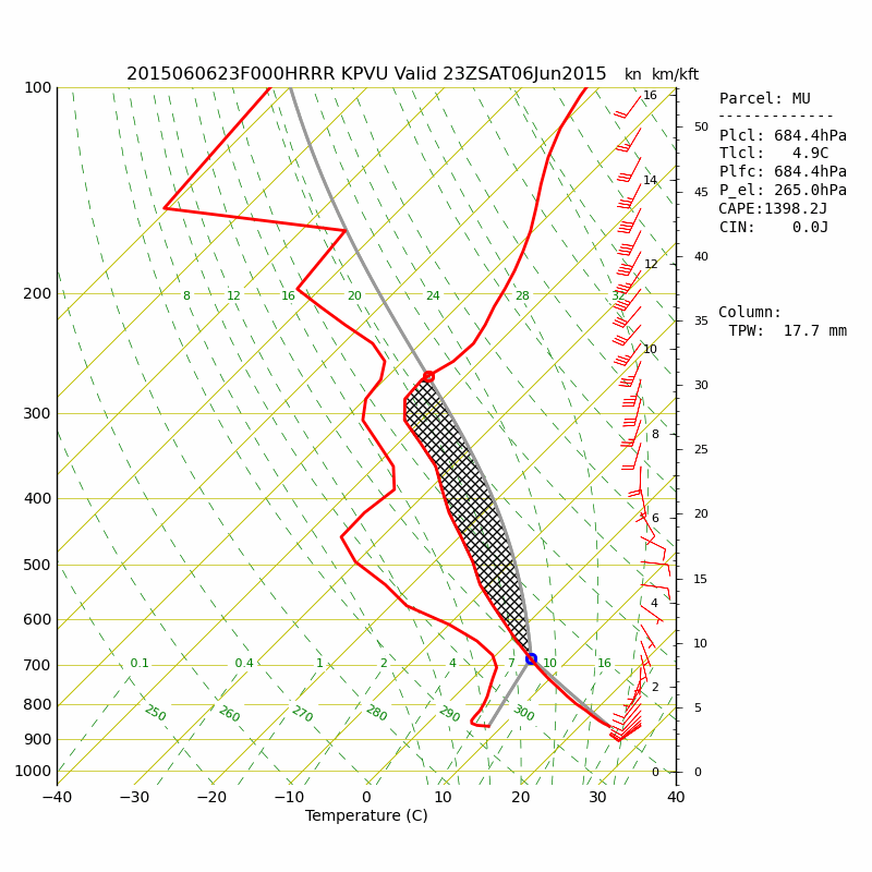
The 5:00 HRRR sounding analysis at KPVU (Provo Airport) shows increasing CAPE throughout the day due to surface heating and lower level moistening. CAPE is the amount of energy available to raise parcels of air and is indicated by the area of the black hashing on the skew-t diagram. Quickly rising air leads to cloud and thunderstorm formation.

Then just three hours later, after the performance had resumed, the  potential of thunderstorm growth was reduced...

Observations at the Eyring Science Center show the 0.86 inches in one hour and a 25 F degree temperature drop as the storm passed.


After the storm passed there were some beautiful mammatus clouds hanging over the stadium.

It was a smart move of the Celebration leaders to temporarily suspend the event while the storm passed. A lightning strike in a crowded stadium would have been a catastrophe. After the storm safely passed, the show went on. It was a fun celebration and I'm glad those youth had the chance to perform what they had spent months practicing.

In other news, hurricane Blanca will make landfall on the Baja Peninsula...