Thursday, February 26, 2015

Snow! What is this...February?

To tell you the truth, I was caught off guard walking out of class when I saw snow accumulating on the sidewalks.
I suspected something about the weather had changed when I saw a fully cloudy sky this morning on my way to school, but I didn't expect snow today. I guess I should have paid better attention to the weather.

From the NWS in Salt Lake:
 AREA FORECAST DISCUSSION 
  NATIONAL WEATHER SERVICE SALT LAKE CITY UT 
  1002 AM MST THU FEB 26 2015 
   
  .SYNOPSIS...A WEATHER DISTURBANCE WILL TRACK SOUTHEAST ACROSS 
  UTAH TODAY. A DEVELOPING STORM SYSTEM WILL AFFECT MUCH OF THE 
  SOUTHERN AND CENTRAL GREAT BASIN THIS WEEKEND. A THIRD STORM 
  WILL IMPACT THE ENTIRE AREA THE FIRST HALF OF NEXT WEEK. 
   
  && 
   
  .DISCUSSION...A WEAK SHORTWAVE TROUGH IS CURRENTLY DROPPING INTO  
  NORTHWEST UTAH AND NORTHEAST NEVADA PER LATEST WATER VAPOR IMAGERY.  
  RAP ANALYSIS SHOWS NORTHWEST FLOW AND 700MB COLD ADVECTION ALREADY  
  UNDERWAY ACROSS NORTHWEST UTAH AND MODELS SHOW THIS WILL CONTINUE TO  
  DEVELOP INTO CENTRAL AND SOUTHERN UTAH LATER TODAY. RADAR ALREADY  
  FILLING IN OVER NORTHERN UTAH WITH LIGHT SNOW REPORTED IN THE  
  MOUNTAINS AND DOWN TO AT LEAST SOME BENCH AREAS ALONG THE WASATCH  
  FRONT. 
   
  EXPECT PRECIPITATION TO CONTINUE TO FILL IN TODAY...BUT GENERALLY  
  LIGHT AND OF A SPOTTY NATURE GIVEN LACK OF A STRONG COLD  
  FRONT...WEAK LARGE SCALE LIFT AND MODEST INSTABILITY. GREATEST  
  AMOUNTS EXPECTED UP NORTH WITH THE BEST INSTABILITY...BUT HAVE  
  UPDATED TO INCREASE POPS A BIT DOWN SOUTH FROM AROUND CEDAR CITY TO  
  GREEN RIVER NEAR AN AREA OF SFC-700MB CONVERGENCE THIS AFTERNOON.  
  OTHERWISE HAVE ALSO INCREASED SKY COVER OVER SOUTHERN UTAH FOR THE  
  REST OF THE DAY AND MADE MINOR TWEAKS TO WIND GRIDS. 
   
  AS THIS STORM EXITS THE AREA TONIGHT...THE NEXT STORM WILL BEGIN TO  
  DROP IN FROM THE PACIFIC NORTHWEST. THIS STORM IS EXPECTED TO CARVE  
  SOUTH ALONG THE WEST COAST...FORMING AN ELONGATED NORTHEAST TO  
  SOUTHWEST-ORIENTED TROUGH AXIS AS THE STORM STARTS TO SPLIT. A  
  CHANCE STILL EXISTS FOR POTENTIALLY SIGNIFICANT SNOW FOR MAINLY  
  SOUTHERN AND PORTIONS OF CENTRAL UTAH UNDER LONG-DURATION  
  PRECIPITATION EVENT LATE FRIDAY THROUGH AT LEAST MONDAY. STILL SOME  
  MODEL DIFFERENCES TO WORK OUT REGARDING QPF AND WHERE THE FOCUS OF  
  HEAVIEST PRECIPITATION WILL BE LOCATED. 

The radar shows this snow is widespread, and the camera display shows that as well.


Looks like this fun weather will stick around a few days...

This winter hasn't really felt like winter, so why the change?
Most of February we the Intermountain West has been the parking spot of a high pressure ridge. This kept our temperatures rather warm and skies clear. This is not the pattern that brings us snow.
Today, the ridge is off to our west, meaning a trough has backed up towards the west. This allows storms to come into Utah.


Model Score

Today on Facebook I saw once again a criticism of meteorologist: "Chance of showers today, they said....."

Yeah, it's an old joke (sometimes appropriate, but many times not).

In my environmental stats class we looked at how well some weather models perform. In the past several decades we have seen much improvement in weather forecasting capabilities (positive trend in graphs shown below). There is an annual variability in the forecast skill. Forecasts tend to be better in the winter months and worse in the summer months. We can also see that the GFS, EC, and UK models trend together with the EC model being the best overall. The CDAS is the worst of the four. 


Below shows how well several models have performed at weather forecasting in the last month. A value of 1 would be a perfect forecast. First, notice that none of the models are perfect. Second, notice that no one model is more right than others all the time. That's why it's important to consider all models when making a forecast. This graphic can be found here.

Granted, these errors are based on 500 millibar heights, which is perhaps the easiest variable to forecasts. The error trends between models for precipitation or wind speed would look quite different and likely have much less forecast skill.

Tuesday, February 24, 2015

Fireball in the Sky

Source: KSL.com
Source: KSL.com
A bright streak of light crossed over Utah's sky late last night around 11:00 pm. I missed it because I was asleep. However, this reminds of me a time when my brother, grandpa, and I were laying on the grass in our backyard probably ten years ago and saw a similar burning fireball. If was loud and the streak nearly crossed the entire sky before fading.

The burning ball of light last night was caused by the remains of a Chinese rocket Yaogan Weixing-26 launched last December. 


The KSL story can be found here.


A list of sightings can be found at the AMS Fireball report page.

If you ever see a fireball you can report the sighting here.

Monday, February 23, 2015

Another Downslope Wind Event

It's another windy day along the northern end of the Wasatch Front. These strong easterly winds often occur when we have a low pressure set up in southern Utah with cold, stable air to our north east. Winds blow cyclonicly (counter-clockwise) around the low pressure center which pulls the cold stable air over the Wasatch Mountains. Since the air is cold and stable, when it passes over the mountains or funnels through the canyons it suddenly sinks and creates the strong winds.

MesoWest weather stations shows that the winds are strongest near the canyons. It was a blustery walk up to campus this morning.
University of Utah: Gusts nearly 50 mph at the Natural History Museum

Bountiful Bench

Hill Air Force Base and Weber Canyon

Brigham City
 The wind advisory is in affect until noon. Winds are expected to weaken in the late morning and early afternoon.
...HIGH WIND WARNING REMAINS IN EFFECT UNTIL 11 AM MST THIS
 MORNING...
 
 * AFFECTED AREA...THE WASATCH FRONT FROM BRIGHAM CITY SOUTH
   THROUGH THE NORTHEASTERN PORTION OF THE SALT LAKE VALLEY.
 
 * WINDS...EAST WINDS 25 TO 35 MPH WITH GUSTS APPROACHING 60 MPH
   NEAR THE MOUTHS OF THE CANYONS.
 
 * TIMING...STRONG EASTERLY CANYON WINDS WILL CONTINUE THROUGH THIS
   MORNING. THESE WINDS WILL GRADUALLY DIMINISHING DURING THE LATE
   MORNING AND AFTERNOON HOURS.
 
 * IMPACTS...STRONG CROSSWINDS WILL IMPACT TRAVEL ALONG THE I-15
   AND US 89 CORRIDORS...ESPECIALLY THROUGH WEBER AND DAVIS
   COUNTIES...AND ALONG THE EAST SIDE BELT OF I-215 IN EASTERN SALT
   LAKE COUNTY. HIGH PROFILE AND LIGHT WEIGHT VEHICLES SHOULD USE
   EXTREME CAUTION WHILE TRAVELING THROUGH THIS AREA. WIND
   SENSITIVE OPERATIONS WILL BE AFFECTED.

While the ozone pollution isn't in the unhealthy range, it is interesting that ozone concentration has stayed flat during this wind event
It appears the background levels of ozone last throughout the night since the NOx titration of ozone is not occurring in the cities during the wind events.

Friday, February 20, 2015

Not much Rain today

On my drive to school this morning I had to turn my windshield wipers on a few times as I crossed the point of the mountain. Looking out across the rest of the valley I could see it was trying to rain just about everywhere else, but it was nothing but virga. Virga is a result of rain evaporating before it hits the ground, like in this picture...

The radar echos, however, make it look like the rain was widespread and heavy. Nope, most of this stuff was evaporating.

Our camera at SunCrest shows a quick set set of snow blowing over. 


The rest of the day has been but quite mild and cloudy with popcorn cumulus sprouting all around and stratus moving in this evening.


Lots of Snow in the Eastern U.S.

NASA's Terra satellite shows the widespread snow cover in the east. Today's been really cold.
Source: NASA
Source: preview.weather.gov/edd

Pictures from MATERHORN: May 2013

Almost two summers ago I participated in the MATERHORN field campaign. Info about the study can be found here and here. My friend Sebastian took some amazing pictures and I wanted to share some of them.
There are no trees out in Dugway, but we still managed to find some shade.
Towers like this were set up all over to measure meteorological data at different levels.
No trees, but there was wildlife. We were the least worried about the antelope
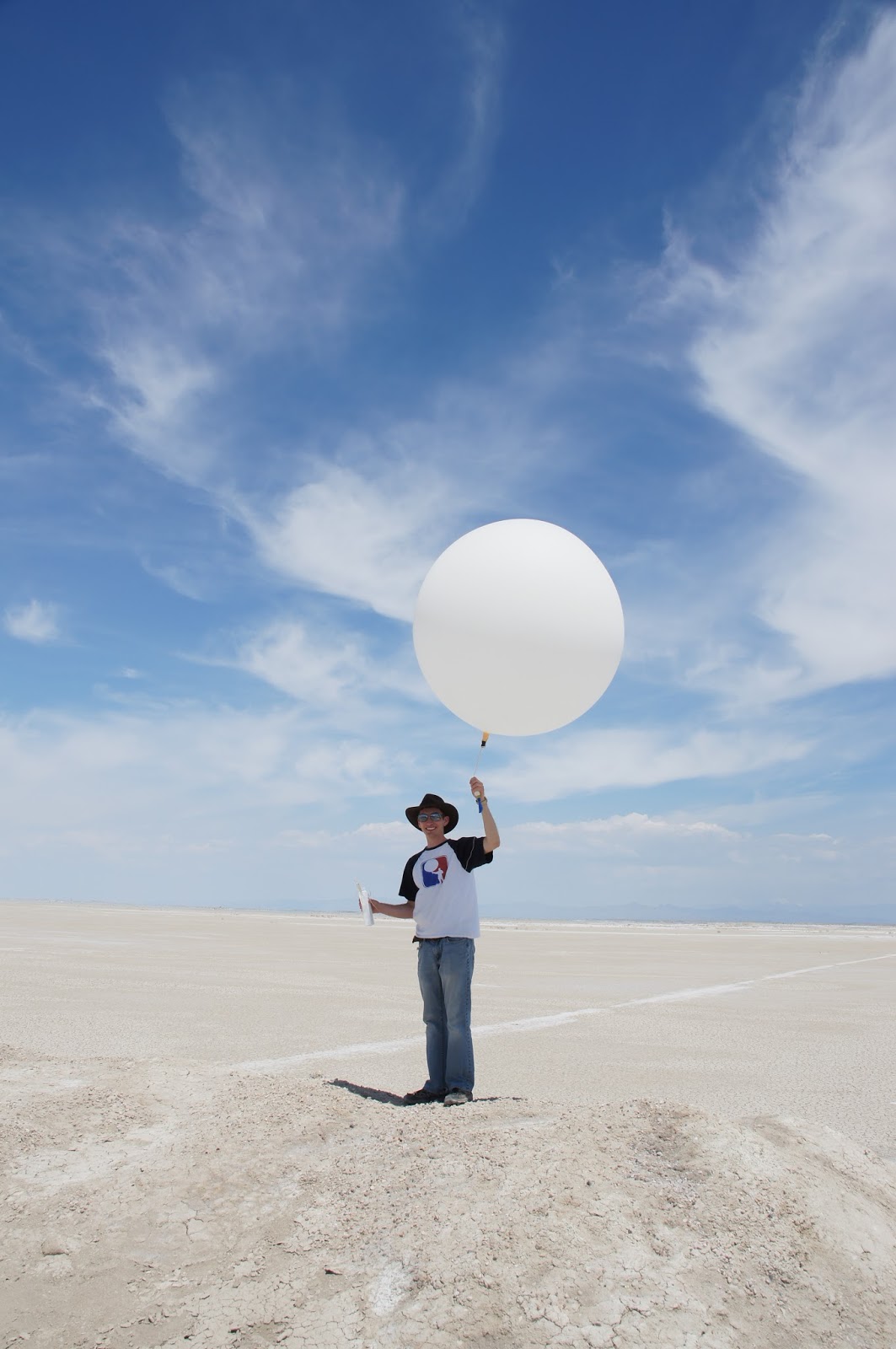
And now a montage of my first weather balloon launch!


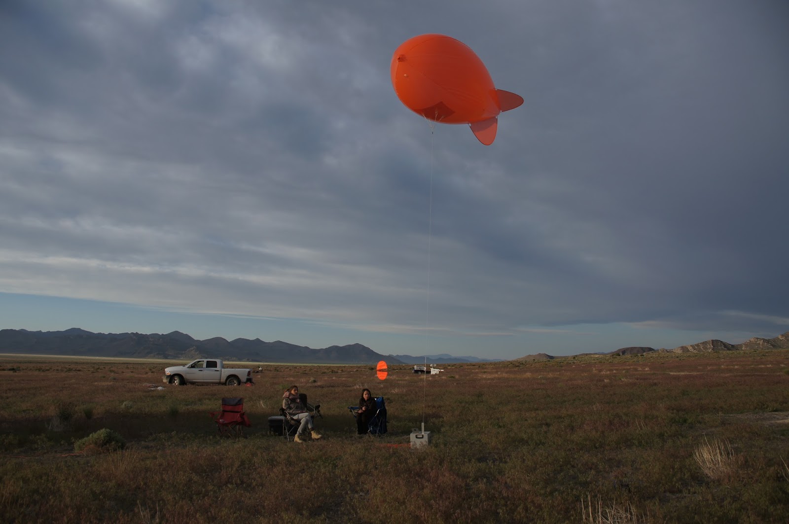
Some students from the mechanical engineering department were testing a new instrument that climbed a tethersonde line.
Tethersondes! Don't they look like goldfish crackers?
Every night was a pretty sunset.

Line of met towers run up the hill. The whit box is a scanning lidar used to measure winds.

Ceilometer used to measure aerosols in the boundary layer.


It was cold in the morning. I was up all night running a tethersonde every half hour. Yeah, I didn't get much sleep that night.
Sonic anemonetor. Uses sound waves to measure wind speed.
Weather stations like this are scattered everywhere.
Another sonic anemonetor

More wildlife! Good thing I saw this before stepping on it.


Lots of lizards

These are known as HOBOs. I can't remember what that acronym stands for.
Sebastian and I climbed Granite Peak looking for all the HOBOs. 


At the top of Granite Peak is this station.

Almost stepped on another snake.

Witnessed a halo one day.
Wild horses.

Sodars are also used to measure wind with sound waves.


Another long night of tethersonde operations.
And again, more wildlife.