
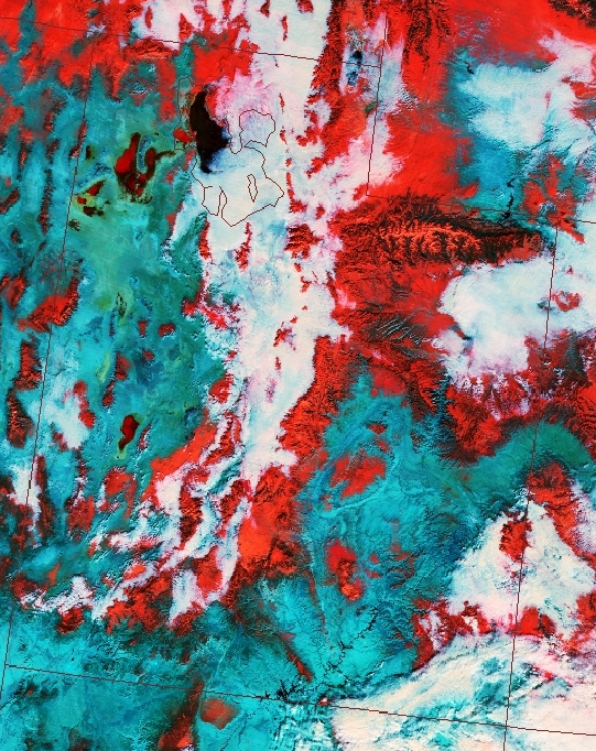
It's hard to see from the true color image what area is cloudy and what area is covered in snow (since clouds and snow are both white.) We can do some cool things with the sensors from satellites. This colorful image helps us distinguishes between the snow and clouds. Blue areas indicate bare ground, red is snow covered ground, and white shows the clouds.
No comments:
Post a Comment
Note: Only a member of this blog may post a comment.