Tuesday, June 30, 2015

Hot Cool Down

It's been a hot week in the western states. Tonight we're getting some relief in some parts. I'm sitting just outside my front door feeling the cool breeze from the downdraft of a thunderstorm.

It looks like there is widespread rain in Utah county, but not many drops are actually.

Wow! Just saw the flash of light from this strike, and heard the thunder...

As I was saying, not many rain drops are reaching the ground. The radar illusion is caused because the rain drops are evaporating before they hit the ground. When the temperature reaches the wetbulb temperature we can expect rain, but a low wet-bulb temperature means the air is dry enough for water to evaporate. Yep, still a large gap between the actual temperature and the wetbulb temperature...


 Evaporating water causes air to cool and sink rapidly. When the sinking air hits the ground it spreads laterally. That is why it has been fairly gusty here in Provo the last 15 minutes. See the recent spike to 15 mph winds...

Tomorrow I'll share and discuss some pictures of rain I experienced in Idaho's Sawtooth Mountain Range this weekend.

Thursday, June 25, 2015

Get ready for a HOT week...or longer


A long spell of 100+ temperatures is on our way, and it's all because of this monster ridge setting up over the western USA.


.SYNOPSIS...HIGH PRESSURE ALOFT WILL STRENGTHEN ACROSS THE REGION 
  THROUGH THE UPCOMING WEEKEND...AND REMAIN OVER THE WESTERN STATES 
  THROUGH NEXT WEEK. 

Wednesday, June 24, 2015

Monday, June 22, 2015

Smokey

From the WBB building looking towards downtown Salt Lake the horizon looks quite hazy likely form the smoke. These dry conditions are not favorable for fires. Already, fires have burned in Canada, Alaska, California, and now Utah. Smoke form these fires has transported into Utah over the last two days. A smoke map shows the location of "hot spots" and the extent of the smoke.


True color images from MODIS show the smoke in California and Alaska from NASA WorldView
California

Alaska


In the News: Great Salt Lake Summer Ozone Study

The Deseret News recently published an article about the Great Salt Lake Ozone study. You can read the Deseret News story here. It's dark, but you can kind of see my hat...
The Nerdmobile. Photo by Jeff Allred

Sunday, June 21, 2015

Longest day of the year

Today is the summer solstice--the longest day of the year. That is, the longest amount of sunlight in a day. You can read more about the summer solstice from this article.

It sure felt like there was a lot of sun today, these were some of the warmest temperatures we've seen all year...
mesowest.utah.edu

The most recent satellite image shows clear skies this afternoon, but there were some high cirrus. You can see the extent of the ridge in the west.
MODIS true color

MODIS true color

My sister took these nice sunset pictures in southern Utah. Enjoy!
photo by RBM

photo by RBM


Thursday, June 18, 2015

Lake Breeze Front moving up Salt Lake Valley

Differential heating of water and land surfaces often causes a pressure gradient to set up between the Great Salt Lake and the surrounding land. This pressure gradient causes winds to blow from the lake to the land on hot clear days like today. From the MesoWest observations shown below you can see the surface winds blow north from the lake. Winds near Draper and Bluffdale, however, are from the south. The lake breeze front hasn't reached that far south at the time this screen shot was taken (7:45 PM)


Doppler radars are used for much more than just tracking rain. We can also how fast the winds are blowing. Below is the radial velocity. That means we measure the speed of objects relative to the radar. A negative value is wind blowing toward the radar, a positive value means wind is blowing away from the radar. Below, the green colors are moving toward the radar (white + north of North Salt Lake) and yellow is moving away form the radar. You can see the lake breeze fill in the Salt Lake valley over time as the winds switch from blowing toward the radar to blowing away from the radar. Also note...this radar is not the National Weather Services' Radar on Promontory Point. This is the TDWR Radar operated by the airport used for aviation and is especially useful for detecting microburst winds during thunderstorms. Since the radar is at ground level it can measure winds closer to the surface. However, there is much more interference from ground clutter and blocking from mountains.

I recently downloaded the raw radar data and plotted it up in IDV. Here is the finished product...

Smoke from San Bernardino Fires

MODIS Satellite images show the extent of smoke from fires in the San Bernardino mountains. Tomorrows weather will likely blow the smoke to the four corners region, not impacting Northern Utah.

MODIS Terra Satellite: 12:00 noon MST

MODIS Aqua Satellite: 3:24 MST

Tuesday, June 16, 2015

June 15 Evening Thunderstom

Last night's thunderstorm in Salt Lake City may have caused and increase in ozone at several air quality monitoring stations. Thunderstorms can cause increased ozone because lightning creates NOx, a compound that is a precurosr pollutant that can create ozone. Also strong downdrafts from thunderstorms can transport stratospheric ozone down to the surface.
Circled in Red is the ozone increase during the time of the thunderstorm.
lighting_ozone
Radar at 23:05 Local time
radar_SLC_20150615-23-05-local
Lots of CAPE that evening from the HRRR sounding (21:00 local time)
HRRRSKEWT_KSLC2015061602F000
Screen shots from a video of lighting captured by Ansley Long
lightning_ansley_longlightning_ansley_long2


And more from Twitter
lightning_twitter

Monday, June 15, 2015

Sunset - June 14, 2015


Floating the Provo River

Another sunny day convinced us to float the Provo river.

We have a sweet flag for our raft. If anyone can guess
the movie reference I'll be very impressed.
A mother and her fawn. Their names are Doe, Ray, and Mi

Friday, June 12, 2015

Short Rainbow

Double rainbow spotted in Springville, Utah on June 11, 2015

This rainbow looks rather short. Why is this?
Rainbows would actually be complete circles if the light were not intercepted by the earth surface (maybe you've seen complete circle rainbows when you look at the sprinklers that water your lawn). The center of the rainbow circle is in the line of sight between the sun at your back and your eye. Rainbows will look short if the sun is high in the sky because more of the rainbow light is intercepted by the surface. When the sun is low in the sky less of the rainbow light is intercepted by the ground and you see more of the full rainbow.

An attempt to illustrate this phenomenon is shown:

Short Rainbow

Tall Rainbow

Thursday, June 11, 2015

"Golfing in a Hurricane"

Are you prepared for the hurricane hitting Utah? Ok, so it's not a hurricane any more. But these clouds and storms are remnants of the moisture from hurricane Blanca. (Weather Underground Article).

Yesterday and today southern Utah has been under flash flood watches. 
Wednesday night the NAM analysis shows widespread moisture across the state. Expect more rain today, but it looks like the moisture pulls out for the weekend. 

While other parts of the state got some rain yesterday, Spanish Fork was sunny--perfect weather for golfing. So here I am, golfing in a hurricane (and sandals) with my brothers...


Sunday, June 7, 2015

Clouds


Photo by C.G., soon be be C.H.

"Due to the severe weather, this event is temporarily suspended"

Haha, so I started writing a blog post on Friday about the rain we would have this weekend. I was going to write about the potential of this rain causing thunderstorms that would delay the Payson Temple Cultural Celebration held in Provo Utah. Well, I never finished the post because I was working on other projects, and never published a warning. So sorry for not saying anything about the storm on my blog yesterday. But, I do have proof from text messages that I told several people about the possibility of rain during the event.

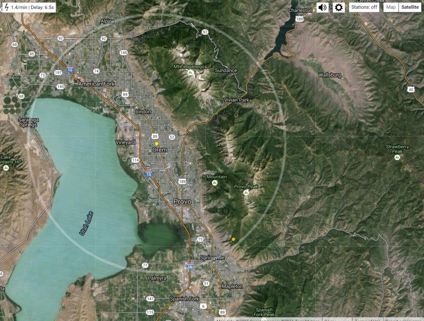
Needless to say, the event was delayed almost an hour due to the thunderstorm. A look at the daily radar shows at 6:00 a thunderstorm passing approaching Provo. It was accompanied by frequent lightning strikes (mostly cloud to cloud as far as I could tell), and large rain drops.

We should be glad this event wasn't delayed due to tornadoes. There were two in Utah near the four corners...


Anyways, my brothers performed in the celebration, an outside event at Lavell Edwards Stadium celebrating the new temple in Payson (KSL Story). It seems like whenever someone chooses a date for an outdoor event months in advance, they automatically change the course of the weather. Saturday evening was a wet one with 0.86 inches of rain falling in the hour the event was supposed to occur.

By 6:00 PM, when we were walking to the stadium, a large thunderstorm was moving  from the south and was getting bigger. We managed to find refuge in a Wendy's right before the rain started to downpour. Our friends came a little later and weren't so lucky. They were soaked when they met us for dinner. The roads had turned to rivers and people were running around with umbrellas and trash bags over their heads.

The day started out warm and mostly sunny with convection developing over the mountains.
 Later in the day, visible satellite image at 7:30 mountain time shows the explosive growth of thunderstorms...


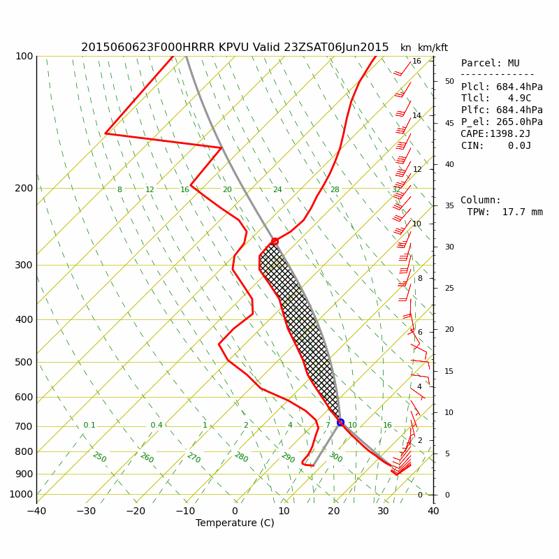
The 5:00 HRRR sounding analysis at KPVU (Provo Airport) shows increasing CAPE throughout the day due to surface heating and lower level moistening. CAPE is the amount of energy available to raise parcels of air and is indicated by the area of the black hashing on the skew-t diagram. Quickly rising air leads to cloud and thunderstorm formation.

Then just three hours later, after the performance had resumed, the  potential of thunderstorm growth was reduced...

Observations at the Eyring Science Center show the 0.86 inches in one hour and a 25 F degree temperature drop as the storm passed.


After the storm passed there were some beautiful mammatus clouds hanging over the stadium.

It was a smart move of the Celebration leaders to temporarily suspend the event while the storm passed. A lightning strike in a crowded stadium would have been a catastrophe. After the storm safely passed, the show went on. It was a fun celebration and I'm glad those youth had the chance to perform what they had spent months practicing.

In other news, hurricane Blanca will make landfall on the Baja Peninsula...